Last month, met with a developer in Phoenix who kept scrolling through street-level renders on his laptop. Nice images. Professional lighting. But investors weren’t biting. The problem? Nobody could see how his mixed-use complex actually fit into the neighborhood. Three weeks later, same project – but this time shown from 200 feet up. Two pre-sales closed within days.
What makes aerial perspectives different from ground views
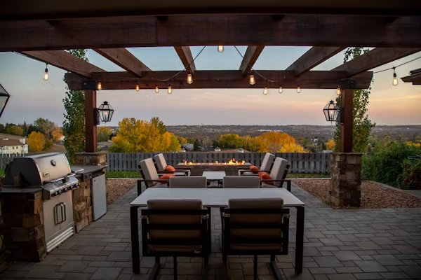
Look, street-level shots work great for showing facade details or that gorgeous entrance you spent months perfecting. But they can’t do what aerial rendering does naturally – tell the whole story in one frame.
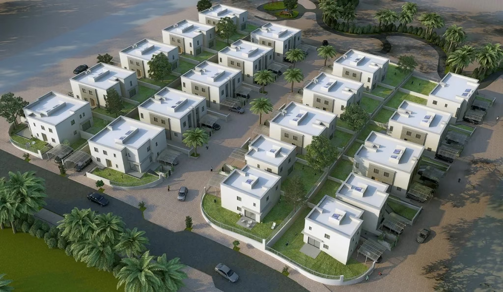
Bird’s-eye visualization creates computer-generated images from elevated angles. Think drone footage, except the building doesn’t exist yet. The camera sits anywhere from 30 to 500 feet up, capturing not just your design but everything around it. Roads. Adjacent buildings. That park two blocks over.
Aerial views reduced client revision requests by 43% because stakeholders finally understood spatial relationships.
Three main types exist. Photorealistic aerial renders aim for that “wait, is this real?” reaction. Every texture matches. Lighting mimics actual sun angles. These run higher in cost but work beautifully for final marketing materials. Conceptual aerial views trade some realism for speed and clarity. Urban planners love these because they highlight design intent without getting lost in decorative details. Interactive aerial renderings let viewers rotate the camera, zoom in on specific areas, toggle between day and night lighting.
Scale matters more than people think. A single-family home with simple landscaping? Might cost around $650 for a decent aerial view. A mixed-use development spanning four city blocks with detailed streetscapes? Could easily hit $3,200 for a single high-resolution image. The difference isn’t just size – it’s the number of objects needing modeling and environmental complexity.
Why developers and architects choose elevated viewpoints
Real estate marketing got transformed somewhere around 2018 when aerial architectural rendering became accessible to mid-size firms (not just the big studios with massive budgets). Before that, you’d maybe hire a helicopter. Expensive. Weather-dependent. And you’re shooting something that doesn’t exist yet.
Projects using aerial visualization in their marketing materials saw 28% faster sales cycles compared to those relying solely on ground-level renders, according to real estate technology research from early 2025.
The practical benefits stack up fast:
- Error detection happens earlier in the design phase. You spot that the service entrance conflicts with the parking flow. Catching these issues in rendering costs hundreds of dollars in changes. Catching them during construction costs tens of thousands.
- Marketing materials gain immediate impact. An aerial view showing your development’s relationship to transit, parks, and amenities? That stops the scroll.
- Approval processes accelerate because planning departments can actually evaluate your project’s neighborhood impact without mentally piecing together how your complex affects traffic patterns from ground-level images.
- Investor presentations become clearer – you’re demonstrating the entire development strategy in visual form. How parcels connect. Where expansion phases could happen.
Rooftop features finally get their moment too. That green roof with solar panels? The rooftop restaurant? Completely invisible in street photography. Absolutely central in an aerial render.
How the rendering process actually works
Starting with CAD files or architectural plans, 3D artists build the base model. Nothing fancy yet – just basic geometric shapes representing your building’s volume. Then comes the detail work. Materials get applied. That brick facade needs texture that looks right from 150 feet up.
Surrounding environment modeling often takes longer than the actual building. Some projects just want the immediate site – your property line plus maybe half a block. Others need full neighborhood context, pulling satellite imagery or existing survey data.
3D rendering software market was valued at $4.21 billion in 2024 and is projected to reach $19.82 billion by 2033, growing at a CAGR of 19.2% – driven largely by demand from architecture and real estate sectors.
Lighting setup separates decent aerial renders from exceptional ones. The sun angle matters. Golden hour lighting makes everything look better, but if your building faces northeast, you’re mostly seeing shadows. Some firms provide multiple lighting scenarios – typically costs around $450 additional per lighting variation.
Camera angles need thought. Too high and you’re basically looking at a floor plan with a slight tilt. Too low and you lose the contextual advantage. Most effective angles sit between 30 and 60 degrees from horizontal, positioned to show your building’s key features while maintaining neighborhood context.
Turnaround times vary wildly. Simple projects with minimal context? A week. Complex developments with detailed surroundings? Two to three weeks isn’t unusual. Rush jobs cost more – usually 25-35% premium if you need delivery in under five business days.
Software choices impact the final result. V-Ray and Corona render engines dominate architectural visualization. AI-assisted rendering tools started appearing in 2023 and 2024, speeding up vegetation generation or texture variations. But the full AI approach? Still not quite there for high-end architectural work.
Batch pricing usually offers better value if you need multiple views. One aerial render might cost $900. Three views from different angles? Maybe $2,100 total. The modeling work gets reused, and choosing a rendering partner requires reviewing their specific aerial portfolio.